The System
This important initiative, envisioned in the Commission for Hydrology and now overseen by the WMO Hydrological Assembly, has been approved by WMO Congress (see Resolution 25 of Cg-18) and intends to provide an operational system capable of assessing the current hydrological status and its likely near-future outlook (sub-seasonal to seasonal time frames) for all areas of the globe. The System will be delivered by National Meteorological and Hydrological Services (NMHSs), offering simple, accessible hydrological information to users such as government bodies, basin managers, funding institutions, aid agencies, UN bodies, and the general public.
HydroSOS is being developed in phases, with the first one being a pilot phase (2017-2021). Under this phase, pilot basins have been identified in Africa and South Asia. This initiative is part of the WMO Strategic Objectives and is aligned with WMO priorities regarding Disaster Risk Reduction, the Global Framework for Climate Services (GFCS), the WMO Integrated Global Observing System (WIGOS), and Capacity Development. HydroSOS is seen as an important tool to help NMHSs deliver their services by providing hydrological products for informed decision-making. In addition, the system, underpinned by hydrological data sharing, meteorological forecasts and climate prediction information with advances from the global research community, will support the 2030 Agenda for Sustainable Development and, in particular, the broader global community in the area of water management.
Presentation on the current progress of HydroSOS
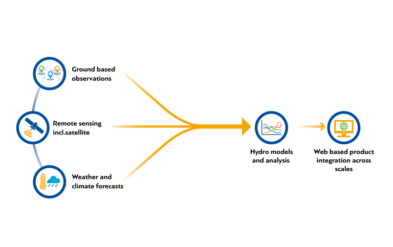
The System will help National Meteorological and Hydrological Services use in-situ observations, remote sensing and modellled data to create hydrological forecasts and integrate them across spatial scales for dissemination through the HydroSOS portal.
End-users
Through the provision of meteorological and hydrological services National Meteorological and Hydrological Services (NMHS) will be able to contribute more effectively to the development plans of their countries. This will help to ensure that they will be able to provide services which will support different sectors such as:
- Agriculture - benefits from hydrological status and outlook products as it will assist with assessments of water prospects for irrigation, planting, harvesting and grazing for both rain-fed and irrigated agriculture.
- Disaster Risk Reduction – will be able to view national, regional and global scale water resources to identify areas at risk of extreme hydrological conditions, enabling informed preparation, risk reduction, and timely deployment of aid.
- Energy – benefits from hydrological status and outlook data for decision support in operations related to water use matching generation, storage, environmental flows and other considerations for power demand.
- Industry – benefits from hydrological status and outlook products in a variety of ways, including understanding of potential restrictions on water abstractions for manufacturing, and modulating effluent releases.
- Environment - will be able to review hydrological status and outlook information to determine environmental risk associated with prolonged and extreme deviations from normal. Both high and low flow conditions pose challenges for pollution, streamflow connectivity and more.
![]()